
Below are some maps of the Cowboy State, the earliest being a breakdown of the Counties in 1872. There were only 4 Counties then: Sweetwater, Carbon, Albany, and Laramie Counties. Each extended from the present day Colorado border northward to the present day Montana border.
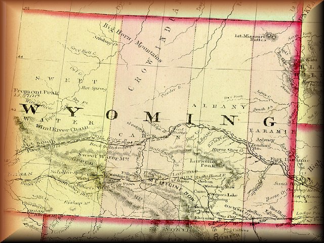
Wyoming in 1872
Modern day Wyoming has 23 Counties, as depicted in the map below. Carbon County is the second biggest in size, smaller only than Sweetwater County to the West. Carbon County encompasses some 7897 square miles today, and has a population of approximately 16,659 people, according the the U.S. Census Bureau, 1996.
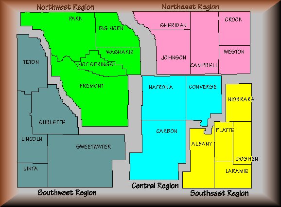
Modern day Wyoming with 23 Counties. Carbon County is located in South Central
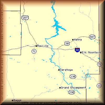
A larger Map of Carbon County
Go to Next: Rawlins: Home on the Range
Go Back to Main Page
Wyoming: Carbon County Facts and Fiction
Page Created: November 21, 1998
Wyoming: Carbon County Facts and Fiction
Created by Arthur J. Jaramillo, WYCarbonCounty@lycos.com
Last Modified: July 29, 2000